Lopburi Regional Archaeological Project – LoRAP (Central Thailand)

Lopburi Regional Archaeological Project – LoRAP

LoRAP started in 1988 with a scientific collaboration agreement between the IsMEO (later IsIAO) and the Archaeology Division – Department of Fine Arts of Thailand (AD-Thai FAD); it has had the constant collaboration (regulated by ad hoc agreements) of the National Museum of Oriental Art ‘G. Tucci ’ for field and study activities and conservation work. Today the project is under the aegis of the International Mediterranean and Oriental Studies Association (ISMEO) which, together with the Ministry of Foreign Affairs and International Cooperation (MAECI), co-finances its activities. LoRAP is co-directed by Roberto Ciarla and – for the Thai part –  first by Surapol Natapintu (Thai FAD- Silpakorn University, 1988-2006) and then Pakpadee Yukongdi (Thai FAD, 2007-present).

Co-directors: Fiorella Rispoli, Supamas Duangsakun
Nation: Thailand
Period: 1988 – in course
La provincia di Lopburi nella Tailandia centrale.
The province of Lopburi in central Thailand.
Immagine satellitare della Piana di Lopburi con la localizzazione dei siti indagati dal Progetto LoRAP (Google Earth)
Satellite image of the Lopburi Plain showing positions of sites investigated in the LoRAP project (Google Earth).
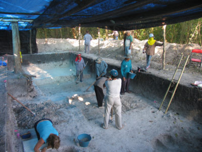
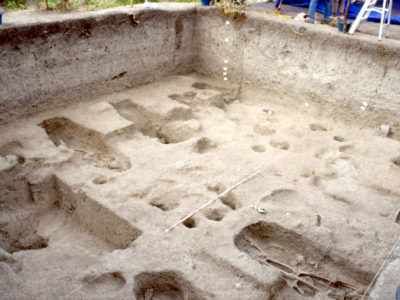
Tha Kae: scavo del livello necropolare dell’Età del Ferro
Tha Kae: excavation of the Iron Age cemetery phase.
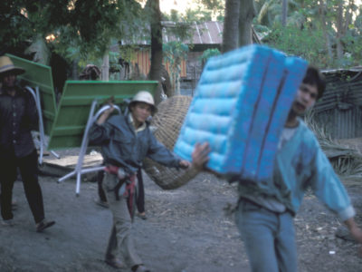
Stagione di scavo 1992: trasporto di suppellettili essenziali per la casa della missione nel villaggio di Huai Pong.
1992 excavation campaign: transport of essential equipment to the mission house in the village of Huai Pong.
Stagione di scavo 1992: trasporto di suppellettili essenziali per la casa della missione nel villaggio di Huai Pong.
1992 excavation campaign: transport of essential equipment to the mission house in the village of Huai Pong.
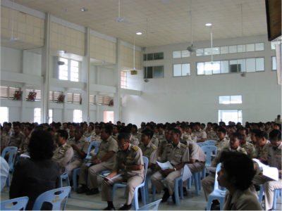
Il Direttore del Progetto parla alla conferenza dei ‘Capi di comune - kamnan’ della Provincia di Lopburi sulla importanza della salvaguardia dei locali siti preistorici.
The project director speaking at a meeting of the ‘council heads – kamnan’ of Lopburi Province about the importance of safeguarding local prehistoric sites.
Noen Din: l’incubo delle foto di scavo senza macchie di sole
Noen Din: the difficulty of taking excavation photographs without sunlit spots.
Noen Din, scavo del livello necropolare dell’Età del Ferro: lo spirito di un vecchio albero va rispettato (si noti a sinistra)
Noen Din: excavation of the Iron Age cemetery phase; respect must be shown for the spirit of an aged tree (on the left).
I bambini del villaggio divertiti dallo scavo e dai farang (gli stranieri)
Children from the village amused by the excavation and the farang (foreigners).
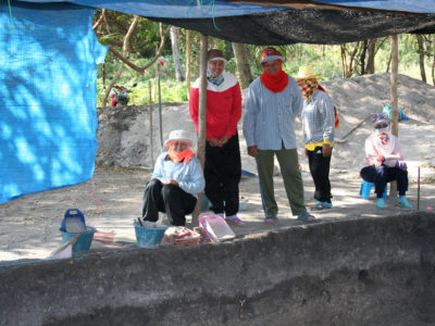
Le nostre operaie temono il sole
Our workers keep out of the sun.
La nostra casa-laboratorio a Lopburi durante la stagione di scavo 2008.
Our house/workshop in Lopburi during the 2008 excavation campaign.

The area of investigation is the Lopburi floodplain, the eastern margin of the great Central Thailand Plain. The plain has a tropical savannah climate and is cut by the Lopburi and Lower Pasak rivers (eastern tributaries of the River Chao Praya); it is dotted with isolated hills and bordered to the east-northeast by the Petchabun-Dong Phaya Yen chain, highlands of sedimentary (limestone and sandstone) and magmatic rocks; at the zone of contact of these two rock types there are copper minerals that were exploited in ancient times.

The project aims to understand the role played by the first dispersion and expansion of rice cultivation, the growth of craft activities and long-distance exchange in the processes leading to the formation of complex societies in central Thailand between 2000 BC and AD 1000, with particular reference to socio-economic dialectics with Chinese and Indian civilizations.

During c.30 years of activity in the Province of Lopburi stratigraphic excavations have been conducted in Tha Kae (Lopburi District) and Phu Noi (Ban Mi District), in Khok Din and Noen Din in the Khao Sai On (Lopburi District) mining area and, at the invitation of the Silpakorn University Archaeology Faculty, in Ban Pong Ma Nao (Patthana Nikhom District). The finds from these excavations, which are stored in the National Museum of the Palace of King Narai in Lopburi, have been studied and given conservation/restoration treatment during numerous seasons dedicated to this work.

Most of the project’s objectives have been achieved; in particular, it has contributed to the creation of a regional chronological sequence applicable to all central Thailand, which is in harmony with the accepted cultural sequences for the entire Southeast Asian continent. The emergence of rice farming in the region, at the beginning of the 2ndmillennium BC, may be seen in the context of the much wider phenomenon (that began in the 4thmillennium BC) of dispersion of groups of rice farmers from the middle Yangtze Valley through southern regions where, as we also have demonstrated, copper metallurgy spread in the late 2ndmillennium BC. It is becoming clear, then, how the growth of craft activities from the first half of the 1stmillennium BC, was but one of the variables in the more general process of the growth of social complexity,  which also involved the first contacts with India, together with more ancient contacts with China, of which tangible evidence has been found in our excavations.

Scavo acrobatico di una sepoltura a Noen Din
Acrobatic excavation of a grave at Noen Din.
Canti e danze Lao nel villaggio di Pong Manao alla fine dello scavo 2002.
Lao songs and dancing in the village of Pong Manao at the end of the 2002 excavation.
Una visita inattesa: Pisit Charoenwongsa, pioniere dell’archeologia preistorica tailandese che con il compianto Chester “Chet” Gorman (1938-1981) scavò il celeberrimo sito di Ban Chiang nella Tailandia nord-orientale.
An unexpected visit: Pisit Charoenwongsa, pioneer of Thailand’s prehistoric archaeology, who with the late Chester “Chet” Gorman (1938-1981) excavated the renowned site of Ban Chiang in northeast Thailand.
Un attimo di relax all’ombra dei lamut, gli alberi di Sapodilla dal cui tronco si ricava la gomma del chewing gum.
A moment of relaxation in the shade of the lamut or Sapodilla trees from which chewing gum is made.

Geoarchaeological surveys have also been conducted, which (although limited by the scarcity of funds) have led to a better understanding of the relationship between humans and their environment over three millennia (2000 BC – AD 1000). This long period of time saw the initial, somewhat limited, interventions to transform the natural swampy environment of the Lopburi Plain by local proto-farmers, which were followed in the 1stmillennium BC by significant deforestation of the mountain slopes and in the plain due to the exploitation of metal ore outcrops, and to the expansion of crop cultivation. The process of socio-economic growth began in the late 1stmillennium BC, with the establishment of centres of social aggregation – settlements surrounded by ditches and embankments – associated with the spread of iron tools and rice paddy cultivation.

This growth was also favoured by the first contacts with the Indian subcontinent (3rd– 2ndcentury BC), as evidenced by the discovery of imports and imitations of “Indian luxury goods”. Control and management of the exchange of these goods by the local elite were strategic for the emergence of state-type structures, which were also based on the adoption and adaptation of Hindu-Buddhist ideological concepts. This socio-political growth is highlighted by the artistic Dvaravati phenomenon, shared by a network of ports, urban and religious centres of Mon language and population in the 7th–  11thcenturies. Of these towns Lopburi, then calledLavo(or Lavapura), was one of the most important; it then became the main Khmer political and artistic centre west of Angkor, at the same time as cultural and commercial exchanges with the Chinese empire were resumed in the 11th– 13thcenturies.

Ospiti dall’Ambasciata Italiana a Bangkok e studenti della Facoltà di Archeologia-Università Silpakorn in visita al cantiere di scavo durante la celebrazione del ventennale del LoRAP
Guests from the Italian embassy in Bangkok and students from the Silpakorn University Archaeology Faculty visit the excavation during the celebration of LoRAP’s 20thanniversary.
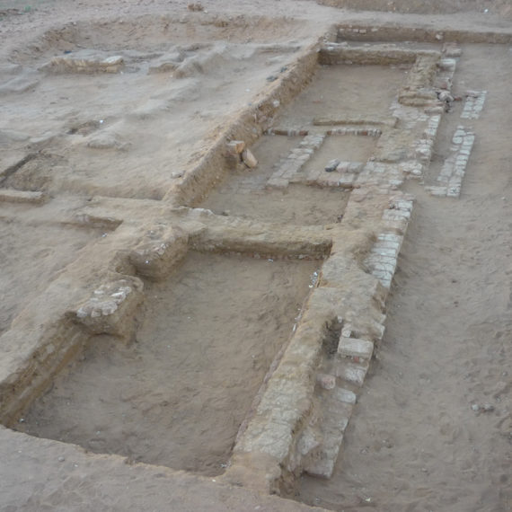
Veduta aerea di Lopburi, antica Lavo (Google Earth)
Aerial view of Lopburi, ancient Lavo (Google Earth).
Vista del Fiume Lopburi a Lopburi
View of the River Lopburi in Lopburi.
Lopburi: il portale d’ingresso al Palazzo Reale di Re Narai
Lopburi: the gateway of King Narai’s royal palace.
Il portale 1 del recinto interno inquadra il Padiglione Chanthara Phisan
Gate 1 of the inner enclosure, framing the Chanthara Phisan Pavilion.
Il Padiglione Chanthara Phisan, già residenza di Re Narai (1633-1688) è oggi sede di speciali eventi espositivi del Museo Nazionale del Palazzo di Re Narai
The Chanthara Phisan Pavilion, formerly the residence of King Narai (1633-1688), now houses special exhibitions at the King Narai’s Palace National Museum.
Il nostro magazzino dei reperti e materiali di scavo nel Museo Nazionale del Palazzo di Re Narai
Our finds and excavation equipment warehouse in the King Narai ‘s Palace National Museum.
Prang Kaek (secc. X-XI), un piccolo santuario hindu dedicato al culto di Brahma nel centro di Lopburi
Prang Kaek (10th– 11thcentury), a small Hindu sanctuary dedicated to the cult of Brahma in the centre of Lopburi.
Buddha Khmer di stile Lopburi (secc. XI-XIII) (Museo Nazionale del Palazzo di Re Narai, Lopburi)
Lopburi-style Khmer Buddha (11th– 13thcentury) (King Narai ‘s Palace National Museum, Lopburi).
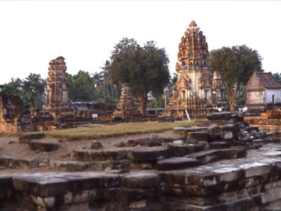
Il tempio reale Wat Phra Si Rattana Mahathat: tempio hindu-buddhista Khmer fondato nel sec. XI fu restaurato e ampliato (ca. 3,3 ha) dal Re Narai (sec. XVII)
The Wat Phra Si Rattana Mahathat royal temple: this Khmer Hindu-Buddhist temple founded in the 11thcentury XI was restored and enlarged (to c.3.3 ha) by King Narai (17thcentury).
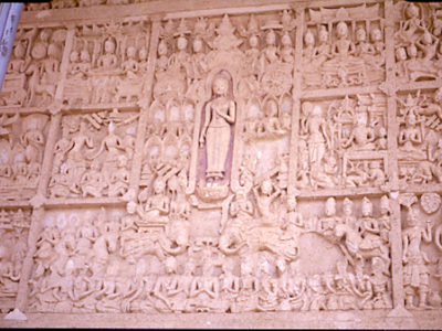
WAT LAI JATAKA
The WAT LAI JATAKA.
Tha Kae: scavo del livello necropolare dell’Età del Ferro
Tha Kae: excavation of the Iron Age cemetery phase.

Le attività di scavo

Print Friendly, PDF & Email